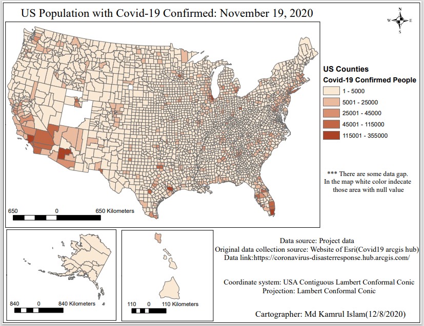
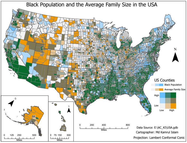
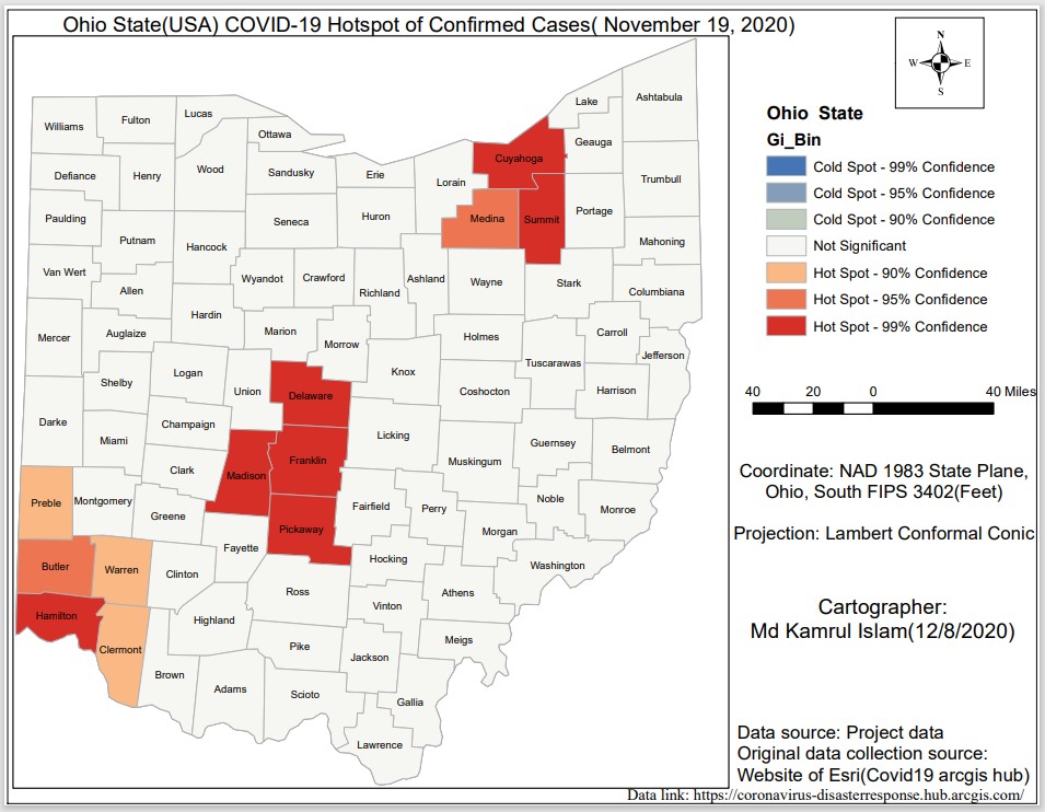
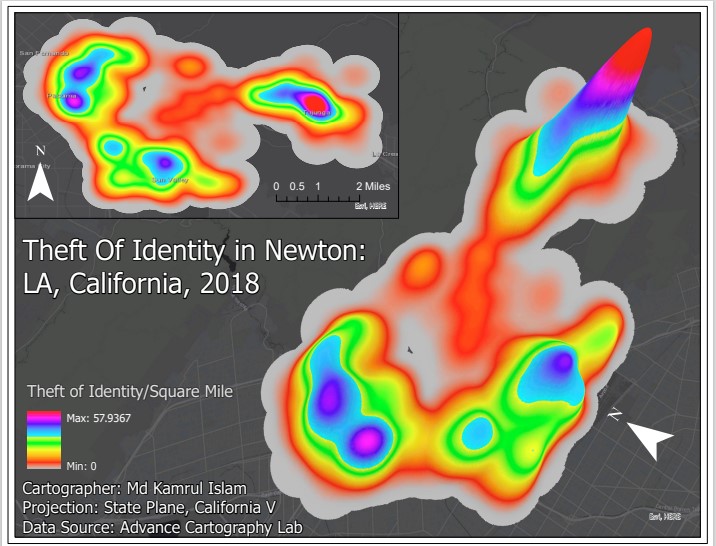
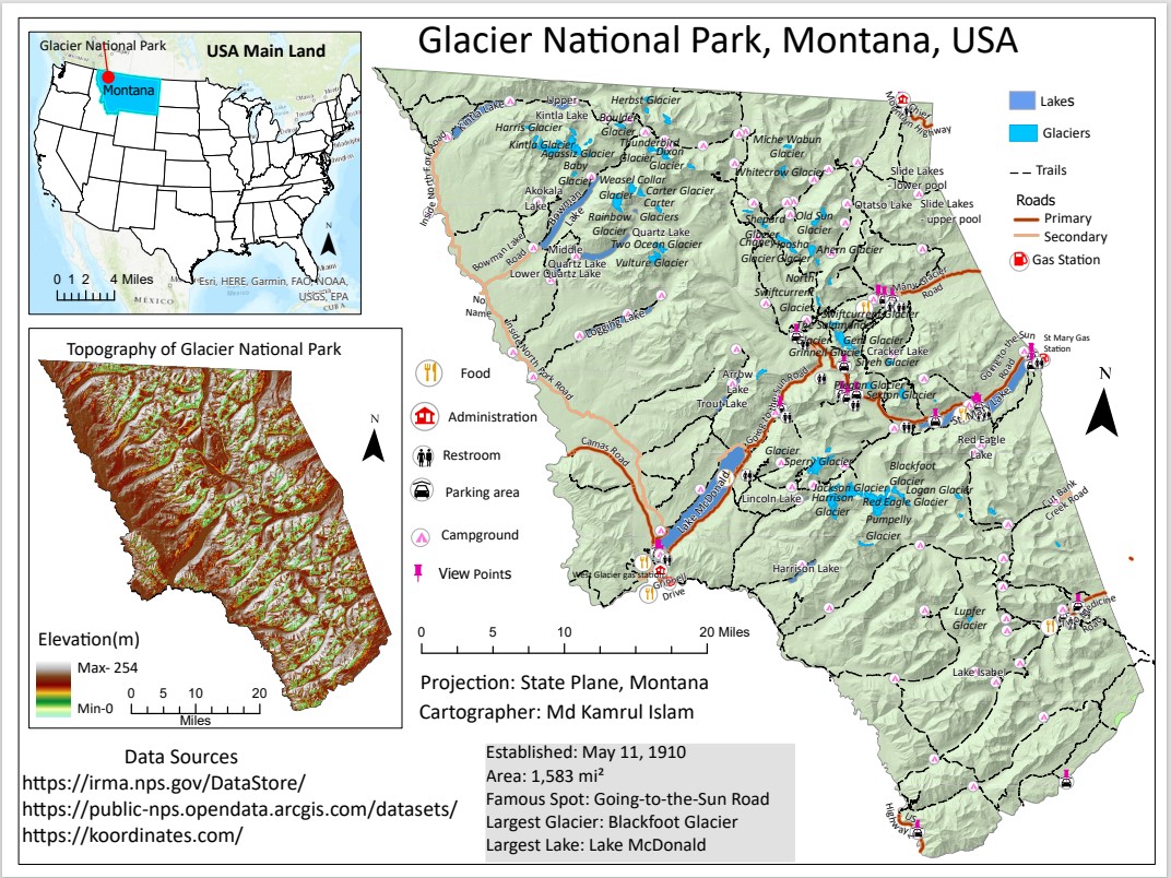
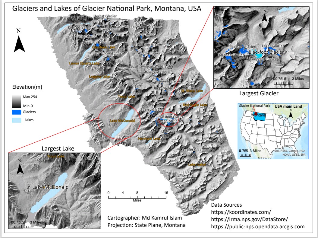
I have advanced proficiency in ArcGIS Pro, with expertise in spatial analysis, geostatistical modeling, raster and vector data processing, and creating high-quality thematic maps. My skills include buffer analysis, interpolation, spatial joins, model builder automation, and 3D visualization for in-depth geographic insights. Here I have added some of the maps I prepared.
Mapping and Visualization with Tableau
I have advanced proficiency in Tableau, specializing in interactive dashboard development, data visualization, and analytical storytelling. I use Tableau to connect complex datasets, create calculated fields, apply filters and parameters, and design clear, insightful visualizations that support data-driven decision-making. Here, I have included several examples for demonstration purposes.
Python for Data Analysis: My Jupyter Notebook Collections
I have advanced skills in Python for data analysis, statistical modeling, and machine learning, including experience with algorithms such as regression, classification, clustering, and deep learning techniques like Convolutional Neural Networks (CNNs). My work involves processing large datasets, building predictive models, and applying cross-validation and performance evaluation methods using libraries such as pandas, scikit-learn, TensorFlow, and XGBoost. Several examples demonstrating these techniques are included in this notebook. Browse through my GitHub-hosted Jupyter Notebooks organized by topic: Remote sensing, GIS, Earth Engine, and Python-based data analysis. Click any folder to view its contents and explore interactive notebooks.